Topic outline

  • Introduction

    FS ScreenWelcome to the online component of the APS - NOAA BWET Workshop.  

    Please take some time and work through the activities in this course prior to the in-person workshop.  

    This course will introduce you to FieldScope, a education focused mapping platform for the Chesapeake Bay region.

    Course Outcomes.  Participants will:

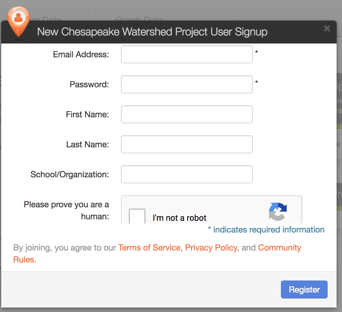
    • Create and log into a FieldScope account
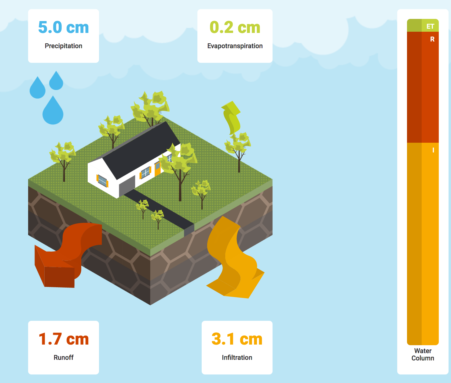
    • Learn how to add data layers and practice querying this data using the analysis tools embedded in FieldScope
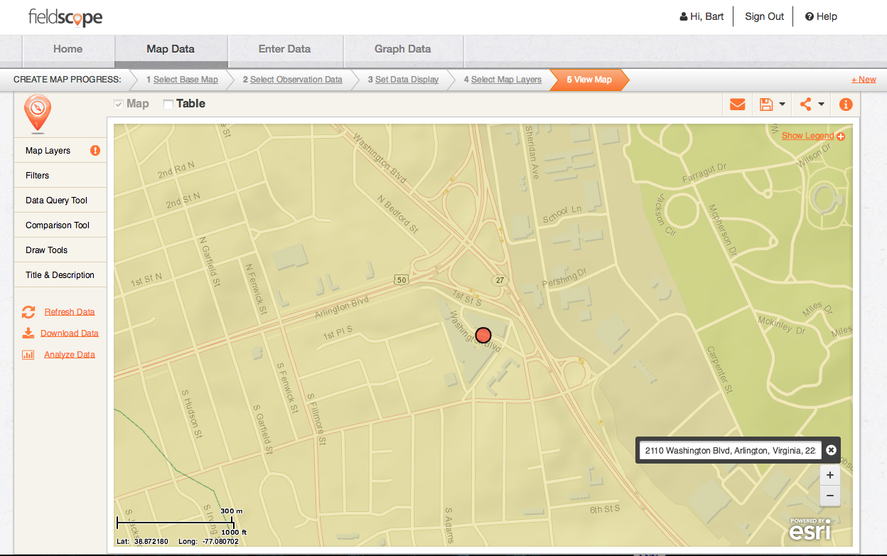
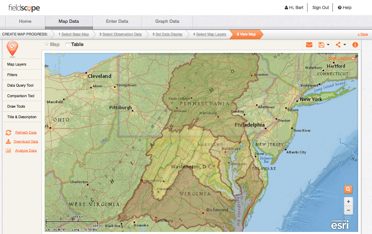
    • Create a map of their school and the school's watershed
    • Become familiar with additional mapping resources available via NOAA and other education focused organizations
  • What is FieldScope

    FieldScope is and education focused Geographic Information System.  It was created to provide students and teachers with access to spatial/geographic data in the Chesapeake Region (as well as others), the ability for users to ask questions about the data, and provide a place for student collected data to be input and analyzed.

    The video below is a good summation of what FieldScope is and some of it's functions.

    Video Link: https://vimeo.com/309916567

    FieldScope Overview from BSCS Science Learning on Vimeo.

    • Creating a FieldScope Account - Please do this before the in-person session

      All users are free to explore the data in FieldScope but to add data (water quality, etc.) and save maps you will need an account.

      Setting up an account in FieldScope is fairly straight forward and similar to other online accounts you may have set up (like the one you set up for use with this course - Chesapeake Exploration).

      FS Login

      1. go to the FieldScope webpage: http://chesapeake.fieldscope.org/ 
      2. In the top right corner of the screen click on the Login link.
      3. A popup window will appear asking you for your login information and providing a link: New To FieldScope? Click Here to Register, click on this link and enter the required information and click on register.
      4. Though it may take up to 24hrs. you will get an email from FieldScope with a link asking you to authorize your new account, click on this link (within 13 days) and you new FieldScope account will be active.
      • Working with FieldScope

        FS 2110 Washington Blvd

        Now that you have an account with FieldScope it is time to further explore the resource (NOTE: you can use the resource as a guest, but you will not be able to save maps or enter data).  In this section the activities below will guide you through some or FieldScope's functionality.  Ultimately you will be creating a map of your school and some data associated with it.

      • WikiWatershed Runoff Model


        Wiki Watershed Model

        The Stroud Water Research Center in Avondale, PA has been developing some interesting educational tools that will help folks to understand the connections between rainfall, land use, and soils in a watershed.

        The Micro Site Storm Runoff Model allows users to learn how land use and soil together determine whether rainfall infiltrates into the soil, runs off into streams or is evaporated and transpired by plants.

        In this section we will be taking a few minutes to explore the engaging resource.

      • Additional Mapping Sites - For Exploration Later

        There are a number of web-based GIS/Mapping tools out there for use by educators.  Below are a list of a few to explore when you have the time or interest in the topic.